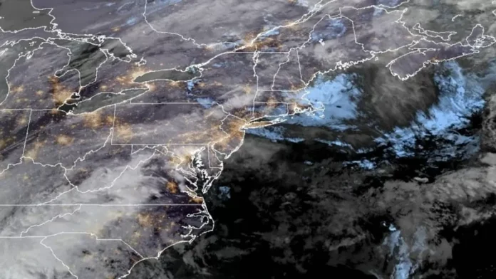
Portland, Maine is bracing for a wild weather ride as a storm system brings a mix of rain, wind, and potentially dangerous conditions to the U.S. East Coast. This whiplash-inducing stretch of weather is due in part to an atmospheric river and a developing bomb cyclone, creating a perfect storm of unpredictable and extreme weather.
Derek Schroeter, a forecaster with the National Weather Service, warns that places like western Maine could experience a range of weather conditions in just one day. From freezing rain to downpours, unseasonably high temperatures, and damaging winds, residents are advised to stay alert and prepare for the worst.
The heavy rain and fierce winds are expected to last until Wednesday night, with flooding being a major concern in some areas. Utilities are also on high alert, ready to respond to potential power outages caused by winds reaching speeds of up to 97 kph.
One of the main factors driving this storm is an atmospheric river, a long band of water vapor that can transport moisture from the tropics to more northern regions. Schroeter explains that this storm has the potential to hit New England hard, as it taps into moisture from the Atlantic Ocean off the coast of the U.S. Southeast and transports it to places like Maine.
Maine is preparing for a “multifaceted storm” that could bring two to three inches of rainfall in some areas, according to Schroeter. Similar conditions are expected in other areas along the East Coast from Tuesday night to Wednesday night.
Schroeter warns of the risk of slick travel on Tuesday night due to freezing rain, and the potential for flash flooding and sharp rises in streams as temperatures rise into the 50s (10-15 Celsius). This is a reminder to residents to exercise caution and stay informed about changing weather conditions.
In addition to the atmospheric river, forecasters are also keeping an eye on the potential for a “bomb cyclone” to form. This is a process known as bombogenesis, in which a cyclone rapidly intensifies in a short period of time, bringing with it severe rainfall and strong winds.
Parts of the Northeast are already preparing for the worst. In Maine, some schools operated on a delay on Tuesday due to a few inches of snow. A flood watch for Vermont is in effect from Wednesday afternoon to Thursday morning.
The city of Montpelier, Vermont is advising residents to take precautions against mild flooding in the area. This includes elevating items in basements and low-lying areas that are prone to flooding. The city is closely monitoring the situation in coordination with the National Weather Service and Vermont Dam Safety.
As the storm approaches, ski resorts in the Northeast are also preparing for potentially messy conditions. Stratton Mountain Resort in southern Vermont is advising visitors to pack their Gore-Tex gear, as it is expected to be a wet day on Wednesday.
Despite the potential for dangerous weather, there is also an opportunity to appreciate the beauty and power of Mother Nature. This storm serves as a reminder of the importance of being prepared and staying informed about weather conditions. So, let’s embrace this wild weather ride and stay safe.

